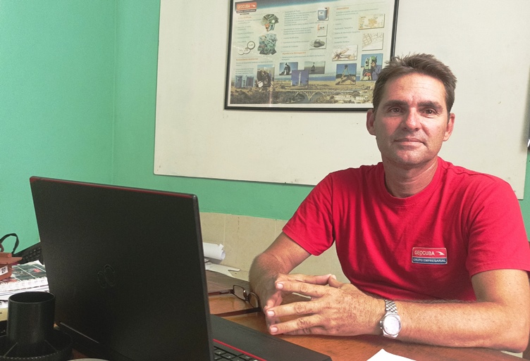
The passion of innovator Yunervis.

Los resultados llegan si se ama lo que se quiere, asegura Yunervis.
Innovators like him defy the impossibilities of creativity and talent, a contribution that is much appreciated in today’s Cuba.

This September 19th, the Union of Civilian Defense Workers celebrates its 53rd anniversary. Innovators like Yunervis Raúl Ruíz Sánchez give it prestige, there is no doubt about that in the province of Matanzas.
A Geocuba worker, Yunervis’ latest contribution is «an online distance table system for route control, which enables the analysis and consumption of fuel for transportation without an odometer (mileage counter), by means of data entry».
Aware of its value, several entities in the province have already contracted the service. «Hopefully other companies will buy it,» he suggests.
However, it is for another contribution that in 2023 it was awarded one of the prizes for the greatest economic and/or social impact, given annually by the National Association of Innovators and Rationalizers.
The award crowns the career of a self-confessed lover of his profession, to the point of considering his work as the best of hobbies, a pastime without which he cannot conceive a life of 33 years linked to this world, to which he arrived as a Geodesy and Cartography technician at the age of 18, in the province of Villa Clara, where he was born.
What is this invention all about? «When in Geocuba we received the mission to carry out a specialized cartography on land use and tenure, we immediately concluded that if we wanted to immediately help food production, the best thing to do was to shorten the deadlines to finish this work».
This was an assignment to all the provinces, derived from the need of the Ministry of Agriculture to know exactly the area and management of the land by the tenants.
The national project, which arose in the scientific-technical unit (UCT) of the Geocuba business group, posed an additional challenge for Matanzas with the time factor. Being the second largest territory (11,791.82 km2) in the country meant spending more than two years to carry out the task.
«Too many months to get the requested information and with the pressure to do it quickly…». In the midst of this crossroads, Yunervis came up with the idea of using technological tools as allies to take the shortest route. One variant, he explains, was satellite images, specifically those obtained with the Copernicus platform of the European space agency.
«Every five days, the station captures images of the Matanzas territory and these data made it possible to get ahead of the days and carry out the work of parcels, without the need to go to the field or walk farm by farm.
«After downloading the images, with a resolution of ten meters, we used free software to classify and process them, and we could see whether the land was ploughed, full of marabú, the state of the central pivots machines or what was harvested.
«What if we used drones? Yes, only in very specific cases. The methodology included them, but, apart from their high cost, it was not feasible to use them in very large areas».
With a pride difficult to hide, the engineer in the specialty of Aerophotogeodesy refers how they managed to obtain an exhaustive control of the land holders, without having to type the data of each file, helped by tools to capture the information and that facilitated to continue reducing time.
What was planned for two years and at a cost of eight million, Yunervis and his team from the Geomatics unit were able to achieve in less than twelve months, with the added bonus of saving energy resources such as fuel, and an economic effect of one and a half million pesos.
In practical terms, the contribution of this procedure developed in Matanzas, which helped enrich the methodology of the UCT of the Geocuba business group, could not be ignored.
«With the new technologies we can do wonders to optimize business management, create products for its progress, but if they are then shelved, they would be throwing away the money resulting from that investment. And that has happened many times, it hurts to say it».
Yunervis arrived in Matanzas in 2010. «They proposed it to me and I didn’t think twice. I am the founder of Geocuba and I have always been accompanied by a maxim: Study, research, always improve myself so that the exercise of innovation is less complex».
Innovators like him challenge the impossibilities of creativity and talent, a contribution that is much appreciated in today’s Cuba.
Photo by the author.
Written by Eva Luna Acosta Armiñán.


