

Tropical Depression Number Two of the current hurricane season forms .
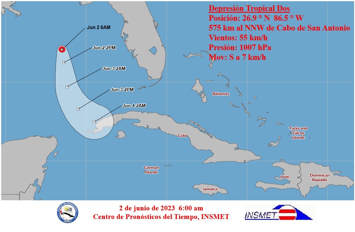
An area of low pressure, which remained with slow movement over the northeastern Gulf of Mexico, has shown signs of improved organization on Thursday, with persistent areas of heavy rainfall in the proximity of its center, informed the Forecast Center of the Institute of Meteorology.
During the afternoon, a survey aircraft investigated this system and determined that it has become a tropical depression.
In its tropical cyclone warning No. 1, referring to Tropical Depression Two, the Forecast Center states that at 5 p.m. its center was located at 28.0 degrees north latitude and 86.6 degrees west longitude, some 615 kilometers northeast of Key West, United States, and 700 kilometers north-northwest of Cape San Antonio, Pinar del Rio.
This system has maximum sustained winds of 55 kilometers per hour, with higher gusts, and a central pressure of 1007 hectopascals (hPa) and drifts to the west-west at only four kilometers per hour.
In the next 12 to 24 hours, it will maintain little movement, beginning to move slowly to the south. Environmental conditions are not entirely conducive to its development, so, although there is a probability that it may gain slightly in intensity and reach the category of tropical storm during the next morning, this process will be short and may weaken in less than 24 hours.
Due to its proximity and future trajectory, although it is a disorganized, weak and short-lived system, it is recommended to pay attention to the information issued about it.
The next tropical cyclone warning for this system will be issued at 6 a.m. this Friday.